uniarq
Centro de Arqueologia da Universidade de Lisboa / Centre for Archaeology. University of Lisbon
Financiado por fundos nacionais através da FCT - Fundação para a Ciência e Tecnologia, no âmbito do Projecto UID/00698
  • Início
    • Contactos
  • Projectos de Investigação
    • Em curso >
      • ARQEVO
      • Projecto Ansor
      • BeArchaeo
      • Projecto Sado Meso
      • Projecto Retorno ao Sado
      • Projecto MegaGeo
      • Projecto IberAmber
      • Projecto Early Metal
      • Projecto FETE
      • Projecto Molião na Antiguidade
      • Projecto Mesas do Castelinho
      • Projecto Os Santuários
      • PALEORESCUE
      • Projecto Produções e interacções
      • Projecto Casa do Governador
      • Projecto Gruta da Oliveira
      • Projecto Gruta da Figueira Brava
    • Parcerias >
      • LO·RI·VAI - Loulé Velho
      • Miño/Minho. Ocupações da margem esquerda do Baixo Minho
      • MOCRATE: Monte dos Castelinhos e a romanização do baixo Tejo
      • PALÆOCOA - Neanderthal to Anatomically Modern Human transition in the Côa Valley: Environments, Symbolism and Social networks
      • VNSP3000 - Vila Nova de São Pedro, again in the 3rd Millennium
  • Concluídos
    • Projecto Castro Marim
  • Investigadores
  • Publicações
    • uniarq digital 99
    • uniarq digital especial 2024: campanhas de verão revisitadas
    • Revista OPHIUSSA
    • Edições da UNIARQ
    • Venda de Publicações / Book Store
  • Arquivo
    • Arquivo Uniarq Digital
    • a UNIARQ na National Geographic
    • Arquivo de Imprensa
    • Eventos anteriores >
      • Curso de Introdução à Geoarqueologia
      • I Curso de Introdução às Línguas e Epigrafias Paleohispânicas
      • ARQUEOZOO
      • International Conference Women and Writing in the Roman West
      • ARCHAEOLOGY ROCKS!
      • Hybrid Seminar: Facing the Last Glacial Maximum: fresh insights into the Gravettian-Solutrean transition in Southwestern Europe
      • Workshop Fotogrametria para estudo e divulgação do Património
      • Workshop Fotogrametria para estudo e divulgação do Património
      • Isto é Arqueologia! 2021/2022
      • Isto é Arqueologia! 2023/2024
      • Partir Pedra 2022
      • Introdução à Geoarqueologia
      • Introdução à Moeda como Fonte de Estudo
      • Identificar, escavar e estudar sítios do Paleolítico Superior em contextos de Arqueologia Preventiva
      • NOITE EUROPEIA DOS INVESTIGADORES 2020
      • Arqueologia em Construção 3
      • Arqueologia em Construção 4
      • Arqueologia em Construção 5
      • Arqueologia em Construção 6
      • Archaeology at Work 7
      • Arqueologia em Construção 8
      • Arqueologia em Construção 9
      • Arquivo 5º CNP
      • Arquivo ZaP2012
      • Exposição de fotografia
      • workshop sigillata 2015
      • MEGA-TALKS 2
      • workshop Leisner
      • curso breve Bua
      • workshop sinos e tacas
      • FRUITS
  • Protocolos
  • Estatutos
  • Informação Institucional
  • Documentos para Candidaturas
  • Formulários, Manuais e Templates
  • Espaços e Equipamentos
  • ARQUEOLit - Litoteca

Vila Nova de São Pedro, again in the 3rd Millennium (VNSP3000)

Andrea Martins, Mariana Diniz, César Neves e José Arnaud
PROJECT OFFICIAL WEBSITE HERE
Imagem
Picture
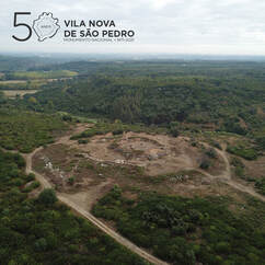
​Vila Nova de São Pedro, again in the 3rd Millennium (VNSP3000) is a multidisciplinary research project designed to deal with the chalcolithic hill top fortified site of Vila Nova de São Pedro (Azambuja, Portugal). VNSP is one of the most significant Copper Age sites in Western Iberia dogged for a long period between 1937 and 1967 by A. do Paço and others. VNSP3000 project started in 2017 and is signed by UNIARQ and Associação dos Arqueólogos Portugueses (AAP) researchers to develop a vast scope of question that range from the 3th millennium BC occupation to site preservation and Public Archaeology. Beside UNIARQ and AAP, local authorities – Câmara Municipal da Azambuja and U.F.M.I.V.N.S.P.M.- are core partners of this project.

Imagem
Imagem
Imagem
Imagem
Vila Nova de São Pedro – power and fear in the 3th millennium BC

In a globalized, densely populated and highly hierarchical world as was the Mediterranean during the 3th millennium cal BC debating Vila Nova de São Pedro’s role implies setting different scales of analysis to deal with local, regional, transregional and long-distance networks in which this chalcolithic site was integrated. Standing alone in an area between Tagus river and Monte Junto mountain VNSP influence transcends its surrounding territory as non-local and exotic products reflects. At VNSP natural landscape and stone architecture were combined to create a powerful display around the site. The chronology of this immense architectural artefact - made to inspired fear/made to protected from fear - is not yet established but by the middle of the 3th millennium cal BC copper metallurgy, bell beaker pottery, weight looms and cheesemakers were part of VNSP technological and economic system.

Imagem
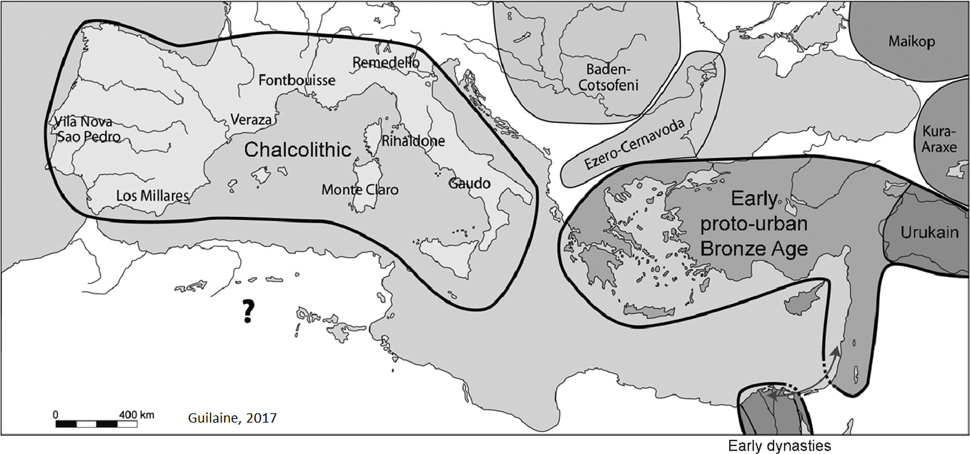
Field work at Vila Nova de São Pedro

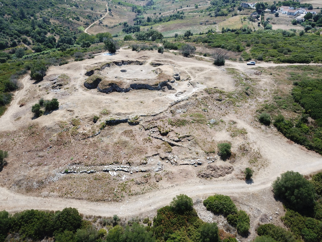
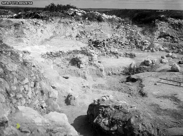
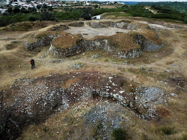
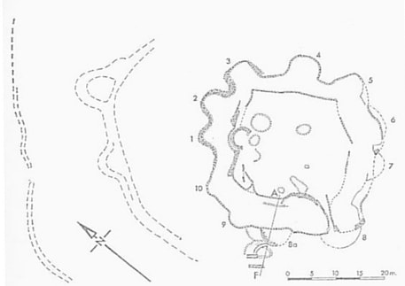
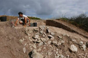
In 2017 field work starts again in Vila Nova de São Pedro with three main goals: i-cleaning the site from a conspicuous shrub vegetation; ii- making a complete topographic map of the (still) existent archaeological features in the landscape; iii- dig areas to solve chrono-stratigraphic issues and building/occupation and abandonment phases of the site.  
 
The removal of 6 tons of shrubs reveals a complex set of stone features not previously document in any VNSP map. The three wall lines published by H. Savory in 1972 are just a part of the stone device built in VNSP. Other stone features, as a stone wall located in the northeaster area of the plateau in front of the bastions 4 and 5, negatives features like the ditch that runs parallel to the inner part of the second wall (?) or even the rampart that contours almost entirely the upper platform where the citadel was built were not previous discussed.

A detailed topographic map is crucial to understand the site where geomorphological and anthropogenic features are combined to hardener the way to the top of this plateau.  The previous estimated area of c. 1ha for VNSP – considering only the stone wall lines presented in Sherrat map is far less than the effective dimensions of the site. The southern and eastern limits should be defined by LIDAR survey.


Picture
Imagem
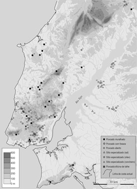
Sousa, 2017 (after Langley & Boaventura map)
Imagem
Imagem
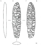
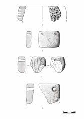
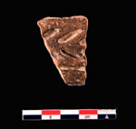
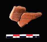
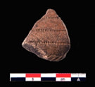
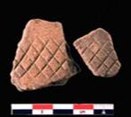
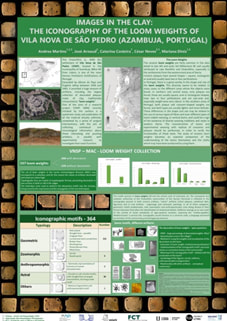
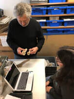
Material Culture Analysis
Imagem
Imagem
Imagem
Imagem
Imagem
Imagem
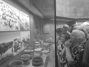
Dissemination and outreach – from peers to public
Imagem
Imagem
Imagem
Imagem
Imagem
Imagem
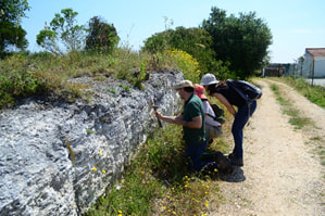
Training under graduated post-graduated students
Imagem
Imagem
Imagem
Imagem
Imagem
Imagem
Imagem
Imagem
Imagem
Powered by Create your own unique website with customizable templates.